Pakistan is a land of magnificent landscapes, rugged peaks, hidden villages, wind-swept plains, ornate mosques, lakes and ancient forts so It’s very hard to rank most beautiful places. Pakistan is an absolutely stunning country. Pakistan for sure isn’t lacking in beautiful places to visit!
These beautiful places to visit in Pakistan simply must find a spot on your travel itinerary when planning your visit.
1. Hunza Valley
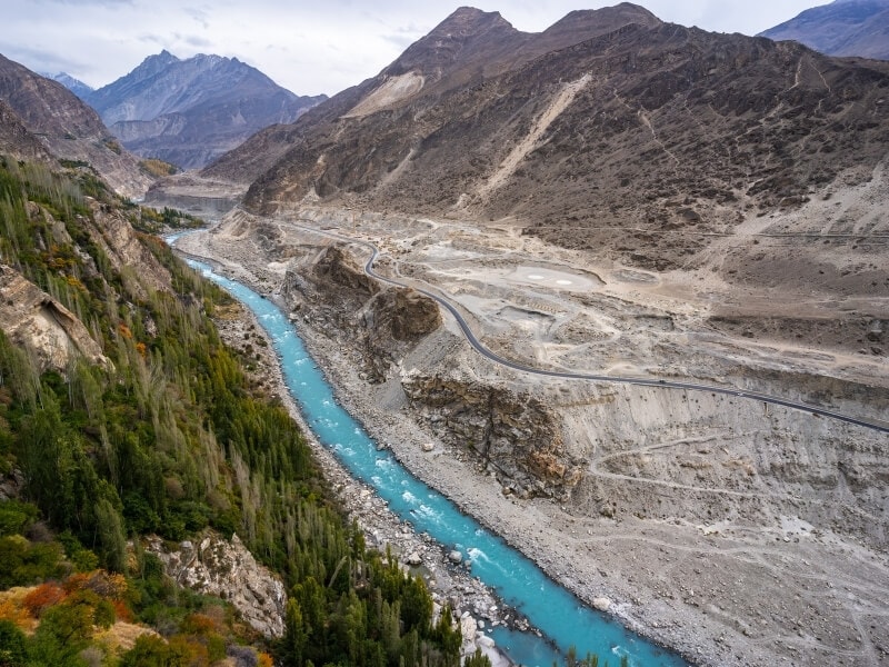
Hunza is a mountainous valley, an elevation of 2,438 meters, in northern part of Gilgit-Baltistan, Pakistan. Hunza valley is bordering with Khyber Pakhtunkhwa to the west and the Xinjiang region of China to the north-east. Hunza is actually a massive district made up of numerous valleys and villages`i.e. Rakaposhi view point, Askoman valley, Gopis valley, Yaseen Valley, Phander valley, Naltar valley, Lower Hunza, Central Hunza (Karimabad), Uper Hunza Gojal valley, Gulmit village, Passu village, Passu cones, Borith lake, Sost dry port, Khunjerab pass, Nagar khas, Hoper glacier, Eagles nest sunset view, Old houses, Baltit fort, Altit fort, Royal garden, Ganesh village, Minapin village, Old silk route, Skardu, Shamgrila etc
2. Kalash Valley
Located in Chitral district, Khyber Pakhtunkhwa, Pakistan, the Kalash Valley Road is one of the most challenging roads of the country. The road is gravel and very narrow with severe drops over the Kalash River. The roads are mostly crossing through a river side and no safety wall for the vehicles with lot of narrow turns, deep and danger terrains. There are some narrow sections -scarcely wide enough for two cars- where if two vehicles have to pass each other, one might have to reverse for some kilometers of winding narrow road to get to a place wide enough to pass. The drive is 17.6km long. It links the villages of Ayun and Grum. The last section of the road is called Rumbur Valley Road, 4×4 vehicles are recommended. The road is in dreadful condition and requires strong nerves to negotiate it. It’s certainly breathtaking and it has a fearsome reputation. Steams are also crossing in between the roads due to cold and snowing weather and freezing temperature these water pools on the roads turned into a solid and freezing snow that further made the task of the drives and pedestrian difficult. Drive with care as this is a mountain road with hairpin curves and dangerous drop-offs.
3. Faisal Mosque
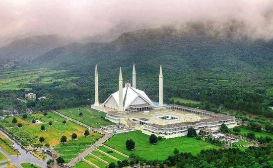
The Faisal Mosque is a mosque in Islamabad, Pakistan. It is located on the foothills of Margalla Hills in Islamabad. Construction of the mosque began in 1976 after a $120 million grant from Saudi King Faisal, whose name the mosque bears. The design features eight-sided shell shaped sloping roofs forming a triangular worship hall which can hold 10,000 worshippers. Combined the structure covers an area of 54,000 square ft, the mosque dominates the landscape of Islamabad.
4. Attabad Lake
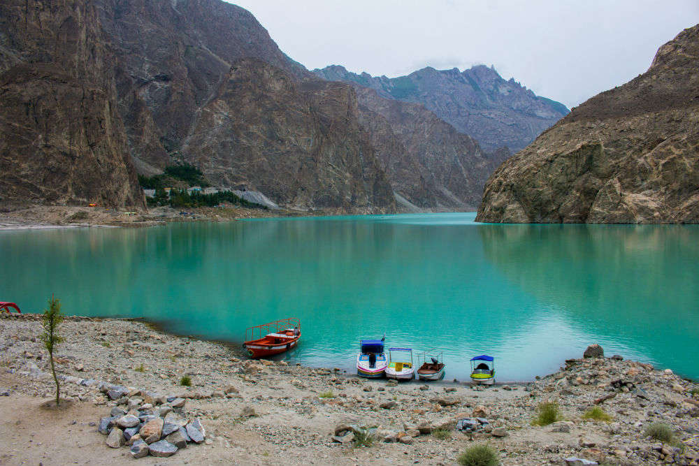
One of the most beautiful lake located in Gojal Valley, Hunza, Gilgit Baltistan. In january 2010, Attabad lake was created accidently, as a result of natural disaster (land sliding). That killed 20 people of Attabad village and destroyed 26 homes. Almost 20 km long lake attracts a big number of tourists because of its beauty and offers many activities like boating, jet skiing, fishing and other recreational activities. Depth of the Lake is almost 109m.
5. Wagah Border
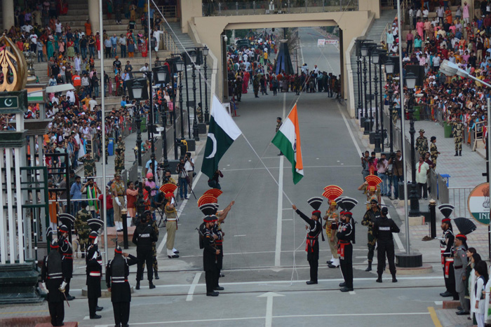
Wahga (Urdu: واہگہ) or Wagha is a village located in the Wahga Zone of Lahore, Punjab, Pakistan. The Wagah town is famous for the Flag Ceremony and also serves as a goods transit terminal and a railway station between Pakistan and India. There is patriotic fervour in the air as people start singing the National Anthem and applauding the ceremony. Wahga is situated 600 metres (2,000 ft) west of the border and lies on the historic Grand Trunk Road between Lahore in Pakistan and Amritsar in India. The border is located 24 kilometres (15 mi) from Lahore, Pakistan and 32 kilometres (20 mi) from Amritsar, India. It is also 3 kilometres (1.9 mi) from the bordering village of Attari. The Wagah ceremony takes place every evening.
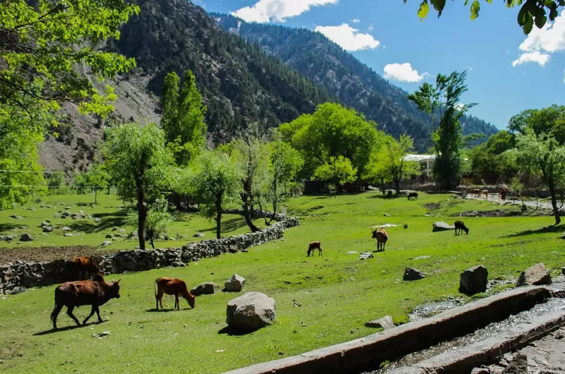
6. Fairy Meadows

Fairy Meadows, named by German climbers and locally known as Jaugth, is a grassland near one of the base camp sites of the Nanga Parbat, located in Diamer District, Gilgit-Baltistan, Pakistan. The meadows offer an incredible view of Nanga Prabat, the world’s 9th highest mountain peak at an altitude of about 3,300 meters above the sea level.
Reaching Fairy Meadows is challenging; a 12 km long jeep track starting from Raikhot bridge on Karakoram Highway to the village Tato and further 5km hiking from Tato (about three to four hours) or by horse.
7. Mohenjo-daro

Mohenjo-daro is an archaeological site in the province of Sindh. Mohenjo-daro is located west of the Indus River in Larkana District, Sindh, Pakistan, in a central position between the Indus River and the Ghaggar-Hakra River. Built around 2500 BCE, it was one of the largest settlements of the ancient Indus Valley Civilization, and one of the world’s earliest major cities, contemporaneous with the civilizations of ancient Egypt, Mesopotamia, Minoan Crete, and Norte Chico. Mohenjo-daro was abandoned in the 19th century BCE as the Indus Valley Civilization declined, and the site was not rediscovered until the 1920s. Significant excavation has since been conducted at the site of the city, which was designated a UNESCO World Heritage Site in 1980. The site is currently threatened by erosion and improper restoration.
8. Badshahi Mosque
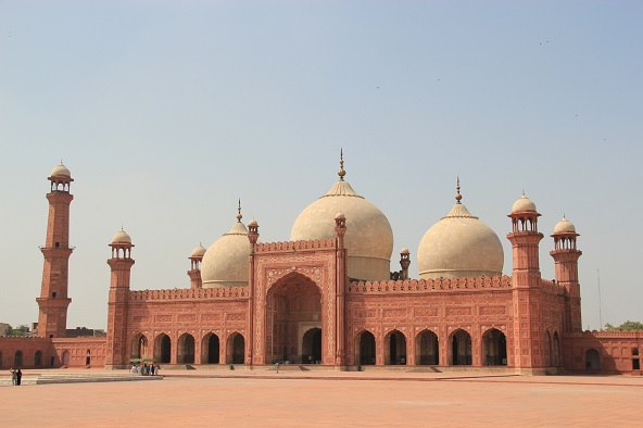
The Badshahi Mosque was built by Emperor Aurangzeb in 1671, with construction of the mosque lasting for two years until 1673. The mosque is an important example of Mughal architecture, with an exterior that is decorated with carved red sandstone with marble inlay. It remains the largest mosque of the Mughal-era, and is the second-largest mosque in Pakistan. After the fall of the Mughal Empire, the mosque was used as a garrison by the Sikh Empire and the British Empire, and is now one of Pakistan’s most iconic sights. It was built with red sandstone.
9. Deosai National Park
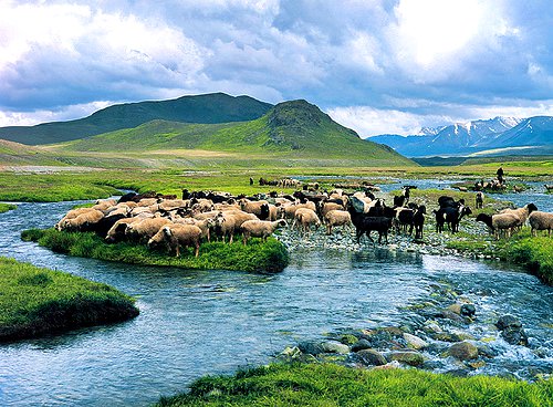
The Deosai National Park is a high-altitude alpine plain located between Kharmang, Astore and Skardu. It is one of the highest large plains in the world at a height of 13700 feet (4,114 m) above sea level, covering an area of 843 km2. Deosai is often referred to as the roof of the world and second-highest plain on the planet.
A beautiful plain is embellished by snow-capped peaks, glistening blue lakes and Sprawling emerald-green meadows.
Because of massive snow in winter, the park is only accessible in summer. The entrance fee is 1,000 rupees for foreigners and 40 rupees for Pakistanis.
10. Katpana Desert

A high altitude desert located in Skardu, Gilgit-Baltistan called the Cold Desert, also known as the Katpana Desert. It sometimes covered with snow in winter, situated at an elevation of 2,226 metres above the sea level. The desert is said to be the highest cold desert in the world.